Forest Service Meeting Summary
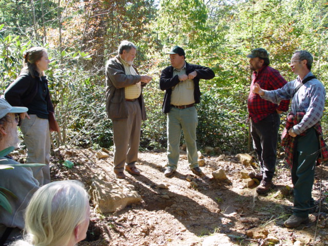
On April 20th, 2011 The Pendleton District Gem and Mineral Society, Pendleton, SC, hosted the second meeting (first meeting was held in 2003) between local mineral enthusiasts, mineral clubs and the US Forest Service.
Present at the meeting were;
Ray Bergeron: Zone Geologist, Francis Marion & Sumter National Forest
Ted Wallenius: Coordinator; Pendleton District Gem and Mineral Society
Richard Jacquot: President; Mountain Area Gem and Mineral Association
Members from the Pendleton District Club, Mountain Area Gem and Mineral Association (M.A.G.M.A.) Clemson University and the US Forest Service.
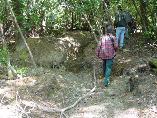
I spoke on behalf of the MAGMA Club and addressed some of the issues concerning rockhounding on Forest Service land in North Carolina. A map of the proposed rockhound collecting area at the Ray Mine in Yancey County, North Carolina was reviewed. The present plan for the Ray Mine includes a study by NC Fish and Wildlife starting in June, 2011, to determine the location/habitat of the bats and to see if the bats have contracted the “white nose syndrome”. If the bats are living in all the mine shafts, the mines will be grated to preserve their homes. If it is determined that only a few of the mines contain the bats, the mines will likely be left open and grated while the others will be closed off by some method, possibly, grating, foam sealing or filling them with the surrounding country rock, trees etc.
At this time the rules for the Ray Mine are as follows. Do not dig anywhere near the creek or on the area known as the Little Ray Mine. The only area that it is permissible to dig with pick and shovel is the designated area that is proposed on the map distributed by the Forest Service at this time. Keep in mind that this is a proposal and has not yet been designated as a rockhounding area. Violations of the current rules will most likely cause problems with the Forest Service and may delay or prevent the designation of this site.
Current rules for the Appalachian Ranger District are as follows; Mineral collecting with pick, shovel and other hand tools is permitted only in the “proposed” collecting area at the Ray Mine, all other Forest Service land in this district is considered surface collecting only. You are permitted to break rocks that are exposed on the surface to examine them for collectible minerals or crystals, no digging is allowed. The only two sites that I know of in the Forest Service in North Carolina that digging and collecting with hand tools is allowed are, the Chunky Gal/Buck Creek Mining District and the Ray Mica Mine.
Ray Bergeron answered numerous questions from members about this, as he is working with District Ranger Tina Tilley on this project. Ray also discussed rules and regulations in other states, specifically Georgia and South Carolina. Currently there is no collecting at all in Georgia. In South Carolina we learned that you can obtain a “letter of authorization” to pan for gold in creeks located on Forest Service land. You can also obtain a permit to collect rocks from Forest Service lands for projects that you may have at your home etc.
Also discussed was the fact that many rockhounds and mineral collectors think that it is a good idea to “hide” from rangers and don’t let them know what you are doing. A good argument for this is the recently proposed project to close four camping areas on NC Forest Service land. The first reason listed for the closures was lack of interest in these camping sites by the community. The proposal states that interest in hiking and mountain biking has increased so that is what the area will be used for. The same thing can be said for mineral collecting. If the Forest Service sees no interest in these collecting areas by hobby collectors, then why should they try to keep and maintain these sites for us? All parties agreed that public awareness of our hobby and communication with the Forest Service was the only way they will consider letting us continue to use this land for our hobby. If you are hiding behind a tree every time a ranger walks by, you only look guilty to the ranger that sees you. I don’t hide from rangers, as I feel I have a right to use the forest land for my hobby. I would rather communicate and collect legally than hide and look over my shoulder all the time.
We presented the Forest Service with a revised rockhound proposal that was initially given to them in 2003. I gave a copy to Ray Bergeron who seemed to care about our concerns and said he would be willing to help us in any way he could. Below is a copy of the proposal;
Proposal for Forest Service
North Carolina, South Carolina, Georgia
April 20th. 2011
TO: U.S.F.S.
RE: MINERAL COLLECTING GUIDELINES PROPOSAL
We have been asked as rock, gem, and mineral hobby collectors (local clubs and private individuals) who use the resources in our state’s Forests—to advise the Forest Service of what we would consider reasonable rules, regulations, etc. adequate to preserve our hobby and allow us continued responsible access to Forest Service properties.
The Forest Service’s concerns include:
1. Damage to creeks, streams and waterways caused by mineral collecting (such as siltation, rerouting of streams, etc.)
2. Damage to plant life (such as undermining of trees, uprooting of shrubs, etc.) by digging.
3. Significant land disturbance, depth of holes dug, trenches, etc.
4. Removal of artifacts found while collecting.
5. Littering at collecting sites.
6. Defining what is considered to be “mechanical equipment.”
We are aware that the existing rules and guidelines for rockhounding on National Forest lands in North Carolina are currently being reviewed and refined. We would like to address each of the above concerns individually to propose what we would consider mutually beneficial and equitable to all interested parties.
First, we as rockhounds and mineral collectors are concerned primarily with preserving access to sites at which we have been allowed to collect for several decades, but which are now in jeopardy of being closed to the public. Subsequently, we do not want to lose sight of other collecting opportunities, such as gold panning and prospecting for new mineral deposits.
The following response therefore keeps all hobby collecting activities in mind. These sites make up a miniscule part of the national forest, and are typically only used by persons participating in our hobby. When you consider how much land in the forest is devoted to logging, hiking, camping, biking, horse riding, etc., the amount of land on which we collect minerals is negligible in proportion to land available to other types of hobbyists and outdoorsmen. All of these other activities/hobbies also result in land disturbances to one degree or another, and we are confident that if an unbiased study were done, it would show that collective disturbance from these other hobbies would far surpass the environmental disturbance caused by hobby mineral collecting. Any criteria for what constitutes “significant damage” to resources needs to be developed with all activities in mind and applied evenly forest wide. A double standard would be unfair to mineral hobbyists.
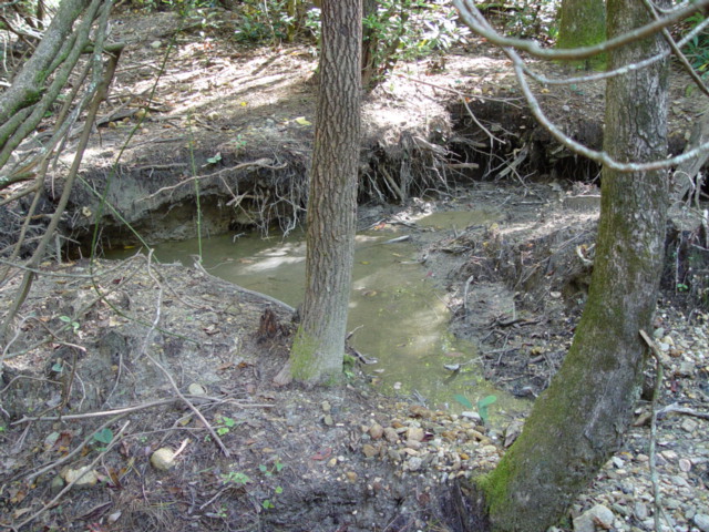
1. Damage to waterways in collecting areas
We understand that this is a problem for the Forest Service as many of our collecting sites have creeks and streams which run through the area. We propose a 3-part solution:
A buffer zone (set distance from the water source) around which we would be allowed to collect. We further propose that no screening or cleaning of minerals take place in the creek or stream. This would work logistically if we could assist the forest service in piping in water from a secondary source for the purpose of cleaning and washing mineral specimens (just as water is piped in to certain areas for the horses on the designated bridle trails). If there was a central washing/cleaning area away from the main waterway, then the buffer zone could be minimal, as the collected material would be taken away from the creek or stream and would not be causing any damage. The buffer zone could be easily established by marking trees or boulders in the area or placing signs with required distances.
If no secondary water source is available, then we propose being allowed to clean and sift material in the creek or stream with some basic rules applied. Gold panning has been an accepted practice in the North Carolina forests for years and has not sparked nearly the controversy that mineral collecting has generated. Sifting and screening for gemstones is very similar to gold panning, but the problem arises when the discarded screened material is piled in one location in the creek or stream. Over time, a large amount can eventually cause the stream to be rerouted. One simple and logical solution is to disperse the discarded material throughout the stream or return it to the hole from which it was removed.
If there is no secondary water source and screening/sifting in the creek is still not acceptable, then collectors should be allowed to use water from the creek/waterway to clean their material at a location outside the buffer zone. If a buffer zone is appropriate for a certain site, the mineral clubs in the region also stand ready to assist the USFS in rehabilitating said sites, returning the streams/waterways to their natural condition (or as close as possible), and filling in all holes and trenches that fall inside the boundary of the buffer zone. By doing this, new collectors will not see the previous condition of the area and will not be tempted to collect inside the set boundaries.
In summary, we suggest either A) a 20-30 foot buffer zone with a secondary water source for cleaning minerals; B) an allowance for the use of water from the waterway for cleaning minerals; or C) permission to sift/clean in the waterway with a couple of simple rules to follow. 1. Disperse unwanted material throughout the area evenly, or 2. Return the unwanted material to the hole it was from which it was removed. Various sites will likely warrant varying restrictions and these alternatives can be used in accordance with individual site conditions and water availability.
2. Damage to plant life
We are aware of the damage caused to plant life in certain collecting areas. We acknowledge the safety hazard inherent in undermining large trees. We believe that small shrubs and bushes warrant less concern unless protected species. Damage to smaller vegetation is typically minimal and growth returns to the point of being overgrown in some areas every season.
We propose there be no undermining or removal of trees over 5" dbh (diameter at breast height) and that any trees in danger of falling be reported to the forest service to be removed for safety reasons. Also, we would like to request that all downed trees and shrubs be taken outside the boundaries of the collecting area for reasons of safety.
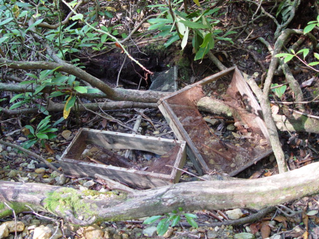
3. Significant land disturbance
Defining “significant” land disturbance precisely is difficult at best. Therefore, we would like to address this issue on several levels.
First, any land disturbance must occur within the boundaries set by the forest service and collectors at any given hobby collecting site. These boundaries would include any old mines/shafts/prospects and all of the dump material that was produced by same.
As previously mentioned, we do not want this proposal to in any way restrict the opportunity to prospect for new mineral digging sites on public forest land. We are simply addressing the current needs of existing sites but would like to preserve the future opportunity to discuss development and management of new and prospective digging sites. We hope to eventually cooperate with the Forest Service to establish a procedure through which new sites can be identified and responsibly accessed and managed.
As for depth of holes, as long as they remain within the boundaries of the collecting area, they could be any depth to be most productive for digging. For example, the Grimshawe Mine in Transylvania County could have a hole depth limit of 3-4 feet deep since the gravel sapphire bearing layer does not extend deeper than this, making it unproductive and unnecessary to dig any deeper. At the Ray Mica Mines in Yancey County, however, holes of any depth desired could be permitted as long as the area is producing dump material from the mine, the primary source of minerals being sought. Of course certain safety rules should be followed. "Dig safe" rules common to mineral collecting hobbyists include:
a. No tunneling.
b. No undermining of boulders too heavy to be moved by hand.
No vertical walls higher than 3-4'; any hole deeper than 3-4' must be tiered, leaving a “terrace” approximately 1' wide every 3-4' around the circumference of the hole.
d. Vertical walls and overhangs cannot be left behind at the end of the day. They must be collapsed to a safe slope.
Following these simple rules would allow safe collecting for all. They would not require filling in holes at the end of the day, but rather making them safe with stable slopes. It would be counterproductive for mineral collectors to have to repeatedly uncover or "dig out" a hole each time they return to it, often several times in a row to exhaust the deposit. Also, when a hole is depleted of any collectible resources, it could be flagged and filled in. This would serve as a sign to other collectors that the area had been dug but would not necessarily prohibit future digging in that spot. Filling in these holes periodically would, however, minimize the long term rearrangement of the landscape.
As far as wildlife is concerned, these animals are used to coping with many dangers in their environment, and many of these mines have been present for decades. The wildlife is familiar with their location and condition. There would be no erosion problem since any erosion would actually contribute to refilling existing holes.
In summary, we suggest setting boundaries around collecting sites, and safe digging rules for collecting.
4. Preserving artifacts
We propose the continued enforcement of the existing rule that any artifacts found while collecting be left as found and the date and location of the find be reported to the local Forest Service office.
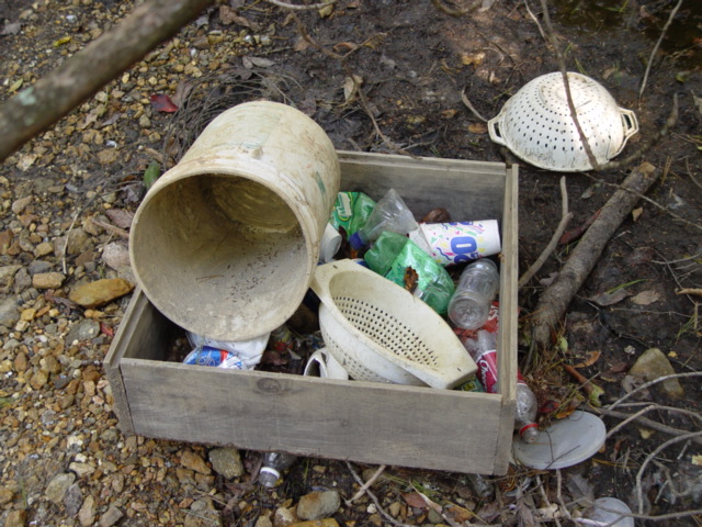
5. Littering and debris
While common sense would dictate that you remove any trash you bring into a site, we know that many do not follow the rules. There is no way to make these individuals comply if they choose to break the law. We, as concerned rockhounds and collectors, commit to policing the areas where we collect, and removing any trash left by others in order to preserve these sites for future collecting.
6. Mechanical equipment
Tools should be broken down into two categories, unpowered hand tools and powered equipment.
Unpowered hand tools would consist of, but not be limited to, the following:
Shovels
Picks / Mattock
Hammers
Chisels
Buckets
Sifting screens
Any other types of unpowered hand tools
Mechanical or powered equipment would include:
Explosives,
Any machinery which is propelled by any type of fuel, electricity, or batteries;
Air compressed tools,
Hand tools which operate on any type of fuel, electricity or batteries.
Mechanical or powered equipment would not be allowed. Basically, if it is powered by hand, it is allowed. If powered by any type of fuel, electricity, batteries, compressed air or nuclear energy, it is not allowed.
We would like to have signs posted at all public forest collecting sites stating the rules and regulations for collecting at that site.
We would also like to ask that our mineral collecting sites be designated as “special use” areas or as “hobby mineral collecting areas.” With this designation, these sites will be among relatively few places we can be legally assured of having ongoing access to ensure the future of our hobby. We hope that the designation process will also address issues of accessibility. We believe that other collecting sites should have vehicular access for our elderly and disabled fellow enthusiasts. Our hobby is shared with a remarkable number of elderly and physically disabled citizens who have as much right to enjoy mineral collecting on public lands as do younger, abler-bodied bikers, hikers, etc. who enjoy the free use of the forest for the pursuit of their hobbies. Restricting vehicular access to these collecting sites unnecessarily is unfair to these individuals. We hope we can work with the Forest Service to improve access to many areas.
The biggest challenge faced by both mineral collectors and the Forest Service is public education and awareness. The public (those who use the forest) see holes dug by collectors and perceive this as damage done to the area. They need to be educated about the hobby of mineral collecting and mining and its many benefits, to individuals, groups and to the public. The public enjoys going to museums to view minerals and gems that come from our earth, but what many do not realize is that many times it is the hobby collector who finds these minerals in the forest and makes them available to the public through loan or donation to public museums.
We sincerely hope that we can work positively and productively with the Forest Service to preserve our mineral collecting hobby. We look forward to participating in future negotiations and planning.
Sincerely,
Richard Jacquot
President; Mountain Area Gem and Mineral Association (MAGMA)
Asheville, North Carolina
Ted Wallenius
Pendleton District Gem and Mineral Society
Pendleton, South Carolina
Doug Dover
President; Foothills Gem and Treasure Hunters Club
Gaston County, North Carolina
I want to commend the Pendleton District Gem and Mineral Society for being the only mineral club in the southeast concerned enough with these issues, not once, but twice, to host these meetings with the Forest Service. I also want to thank Ray Bergeron for his advice and input and suggestions. Ted Wallenius and Doug Dover for their help in authoring the proposal we presented, and all the concerned rockhounds who took the time to come to this meeting. Hopefully we can continue to work with the Forest Service and maybe get more sites designated in the future for our hobby.